Grand Teton National Park: Trails Illustrated - National Park Maps (ISBN: 9781566954372)
Grand Teton National Park: Trails Illustrated - National Park Maps (ISBN: 9781566954372)

Oferte pentru produsul Grand Teton National Park: Trails Illustrated - National Park Maps (ISBN: 9781566954372)
Ofertele pentru produsul
Caracteristici, descrierea produsului - Grand Teton National Park: Trails Illustrated - National Park Maps (ISBN: 9781566954372)
Descrierea produsului
| Genul | Ghid turistic, Ghiduri, Limbi străine |
Ați găsit greşeli în descrierea produsului? Vă rugăm să ne trimiteți o notificare!
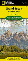
- Waterproof - Tear-Resistant - Topographic MapExpertly researched and created in partnership with local land management agencies, National Geographic's Trails Illustrated map of Grand Teton National Park provides an unparalleled tool for exploring this magnificent region. This map offers unmatched detail of the entire park and features key areas of interest including Jackson Hole, Jackson Lake, Colter Bay Village, Jenny Lake, Phelps Lake, Teton Crest Trail, Bridger-Teton National Forest, Caribou-Targhee National Forest, Gros Ventre Wilderness, Jedediah Smith Wilderness, and John D. Rockefeller Jr. Memorial Parkway. With almost 250 miles of mapped trails in some of the most breathtaking scenery in the entire country, the Grand Teton National Park map can guide you off the beaten path and back again. The trails are clearly marked to help with navigation for backcountry explorers. Suggested backpacking trips, weather and safety tips, and information about other recreation activities are included to help guide you in enjoying all the park has to offer. The map base includes contour lines and elevations for summits, passes and major lakes. The bathymetry of Jackson Lake is shown with both contours and hill shading. Some of the many recreation features include: campgrounds, trailheads, parking lots, scenic overlooks, interpretive trails, and backcountry camping zones. Every Trails Illustrated map is printed on "Backcountry Tough" waterproof, tear-resistant paper. A full UTM grid is printed on the map to aid with GPS navigation. Other features found on this map include: Grand Teton, Grand Teton National Park, Gros Ventre River, Gros Ventre Wilderness, Jackson Hole, Jedediah Smith Wilderness, Jenny Lake, John D. Rockefeller, Jr. Memorial Parkway, Mount Moran, Rendezvous Mountain, Targhee National Forest, Teton National Forest, Teton Pass, Teton Range, Teton Wilderness. Map Scale = 1:80,000 1:31,680Sheet Size = 25.5" x 37.75"Folded Size = 4.25" x 9.25"
Prețurile și informațiile de pe paginile noastre sunt furnizate de magazinele partenere și au caracter informativ, unele erori pot apărea. Imaginile produselor au caracter informativ, uneori pot include niște accesorii care nu sunt mereu incluse în pachetul de baza. Informațiile aferente produsului (imagine, descriere, preț) se pot schimba fără notificare prealabilă. Compari.ro nu își asumă responsabilitate pentru eventualele greșeli.
